
COASTAL NAVIGATION VS. OCEAN NAVIGATION: A COMPLETE GUIDE
Navigation encompasses everything from freight transport to tourism and exploration. In the maritime field, two main categories define the type of operations: coastal navigation and ocean navigation.
Understanding their differences is fundamental for navigators, enthusiasts, and maritime professionals, as it ensures the execution of safe, efficient operations in compliance with legal regulations. Each of these modalities requires distinct preparation, specific equipment, and differentiated technical knowledge.
COASTAL NAVIGATION
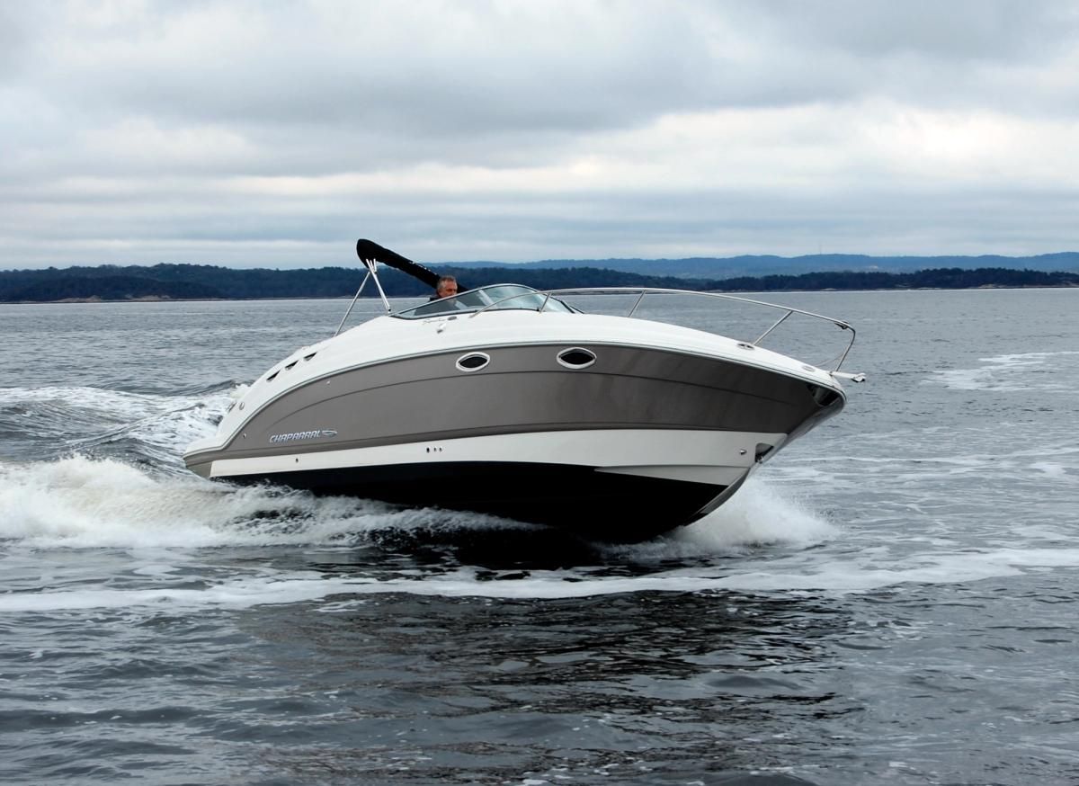
Coastal navigation comprises voyages carried out along the shoreline, generally remaining within a range of 20 to 50 nautical miles from the shore, in accordance with international and local regulations. It is characterized by routes that allow one to see the coastline, which facilitates orientation and provides quick access to ports and refuge areas in case of emergency.
- Maximum distance: Generally up to 50 nautical miles (92.6 km).
- Typical speed: 10 to 25 knots.
- Duration of voyages: From a few hours to a couple of days.
- Visibility: Continuous coastal references (lighthouses, geographical features, port infrastructure).
- Typical vessels: Sailboats, motorboats, fishing vessels, ferries, and recreational yachts.
- Local and regional transport.
- Commercial and sport fishing.
- Maritime tourism and coastal cruises.
- Maintenance operations, buoying, and maritime salvage.
OCEAN NAVIGATION
Ocean navigation consists of voyages across open sea, frequently exceeding 100 nautical miles (185.2 km) from the coast and navigating without visual references on land. This modality requires meticulous planning and highly complex technical preparation.
- Distance: Hundreds to thousands of nautical miles.
- Typical speed: 15 to 35 knots (depending on the type of vessel).
- Duration of voyages: Days to weeks.
- Visibility: Total absence of land references (horizon only).
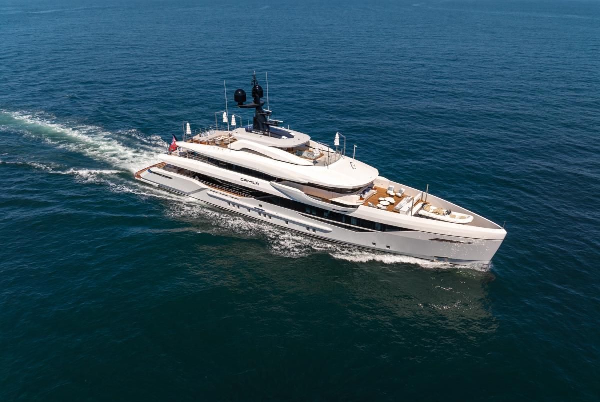
- Typical vessels: Merchant ships, tankers, container ships, large cruise ships, and large or ocean-going yachts.
- International trade and large-scale freight logistics.
- Scientific expeditions and ocean exploration.
- Naval and military operations.
- Adventure navigation and offshore regattas.
COASTAL VS. OCEAN NAVIGATION
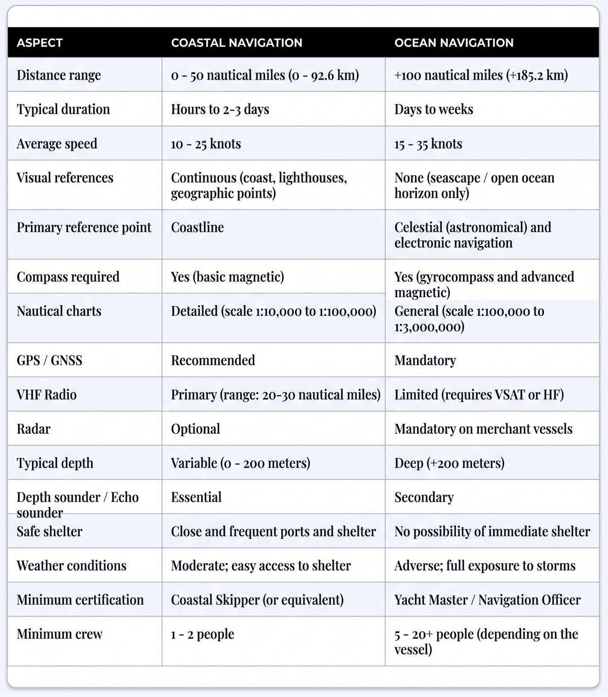
1. Geographic and Operational Limits
- Coastal Navigation: Restricted to proximity of the shoreline (20–50 nautical miles). Takes advantage of fixed visual aids (lighthouses, navigation marks, coastal relief) for course plotting and allows frequent course adjustments following the geographic contour.
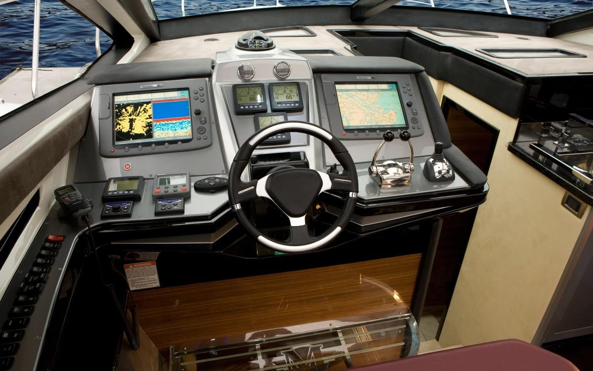
- Ocean Navigation: Has no preset geographic limits. Requires knowledge of astronomical navigation and absolute dependence on radionavigation and satellite systems (GPS, GNSS, radar, AIS, and Satcom). Courses are calculated and planned days or weeks in advance.
2. Climatic Conditions and Safety
- Coastal Navigation: When threatened by bad weather, vessels typically seek shelter quickly in a port or cove. Tides and currents are predictable and widely documented. Rescue coverage with response times of minutes to a few hours.
- Ocean Navigation: Vessels must be capable of weathering storms in open sea with no option of land shelter. Wave heights of 3 to 10 meters (compared to 0.5 to 2 meters on the coast). Response to emergency salvage situations may be delayed hours or days.
3. Equipment and Technical Preparation
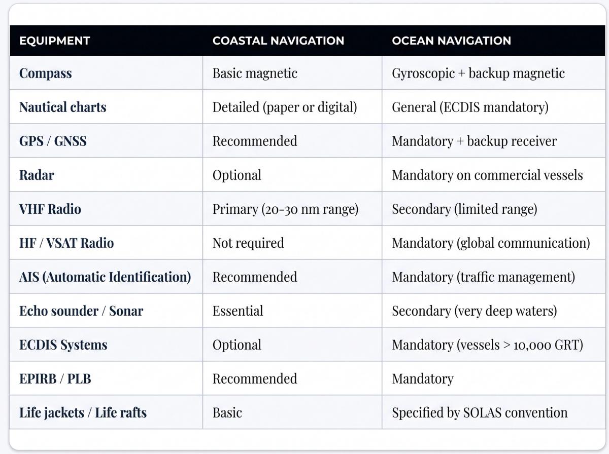
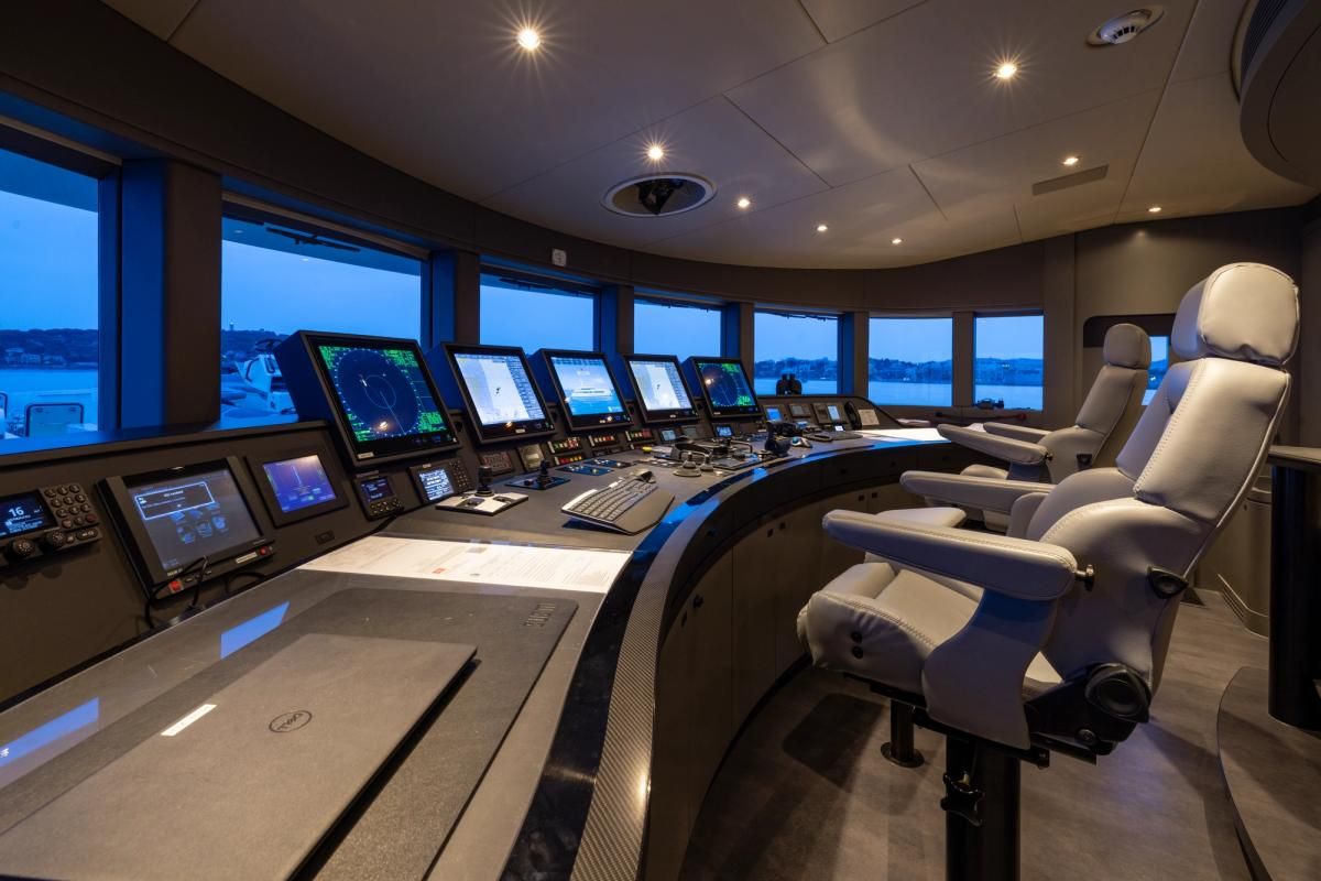
CREW AND TRAINING:
- Coastal Navigation: 1–2 people with basic recreational certifications or coastal professional qualifications (e.g., Coastal Navigation Master).
- Ocean Navigation: Multidisciplinary teams of 5 to more than 20 people with higher certifications (Yacht Captain, Watch Officer, meteorologists, engineers).
HISTORICAL NAVIGATION METHODS
Although digital technology dominates modern nautical practice, it is interesting to recall how both modalities evolved throughout history:
Coastal (Historical)
- Visual piloting: Positioning by marking notable points on the coast.
- Portolan charts: Detailed medieval cartography with networks of compass bearings.
- Lead line: Measurement of water depth and collection of seabed samples to determine position.
Ocean (Historical)
- Astronomical navigation: Determination of latitude and course using the sextant and study of celestial bodies.
- Log and sand glass: Measurement of ship's speed by counting knots that passed through the sailor's hand in a determined time.
- Marine chronometer: Eighteenth-century invention that allowed precise calculation of geographic longitude on the open sea.
OTHER TYPES OF NAVIGATION: INLAND NAVIGATION
In addition to coastal and ocean navigation, there is inland or river navigation, which develops in:
- Navigable rivers and canals
- Lakes, reservoirs, and large freshwater surfaces
- Protected inland and intercoastal waterways
- It is conducted in continental waters, generally protected and with limited depths.
- It requires mastery of maneuvering in confined spaces, lock management, and knowledge of river current regimes.
- Typical speeds: 5 to 15 knots.
- Specialized vessels: Barges, pushboats, tugboats, and river launches.
- Certification: Inland or River Waters Master.
CONCLUSIONS
Investment in proper training, maintenance of on-board equipment, and rigorous planning are the fundamental pillars that every navigator must prioritize before setting sail, regardless of the distance that separates them from the coast.
#CoastalNavigation #OceanNavigation #MaritimeSafety